
Great Lakes Pictures, Images and Stock Photos
Browse 71,300+ great lakes stock photos and images available, or search for the great lakes or great lakes aerial to find more great stock photos and pictures.
the great lakes
great lakes aerial
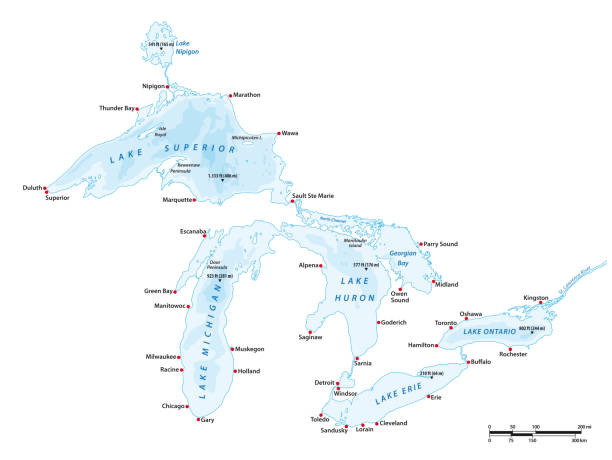
great lakes map
lake superior
lake michigan
great lakes michigan
great lakes canada
great lakes vector
great lakes ship
great lakes satellite
great lakes freighter
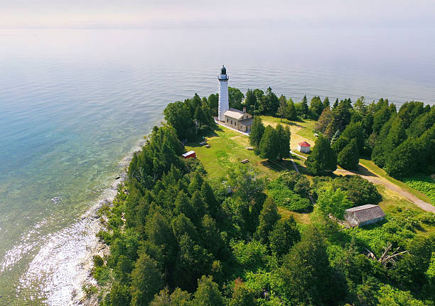
great lakes lighthouse
map of great lakes
great lakes region
great lakes chicago
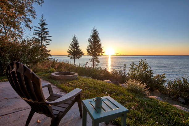
great lakes sunset
great lakes sailing
great lakes silhouette
great lakes fishing
great lakes science center
great lakes landscape
great lakes usa
great lakes wildlife
great lakes cruise
whale great lakes
great lakes storm
aerial view great lakes
great lakes winter
great lakes summer
great lakes shipwreck
Most popular

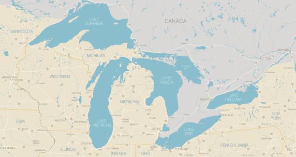
Vector graphic of the North American great lakes and their neighboring countries
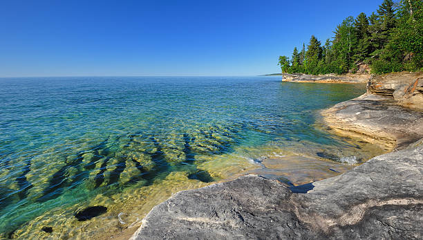
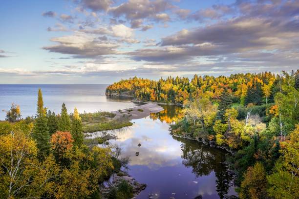
Pristine clear waters of Lake Superior Pictured Rocks National Lake-shore ,near Munising, Michigan USA
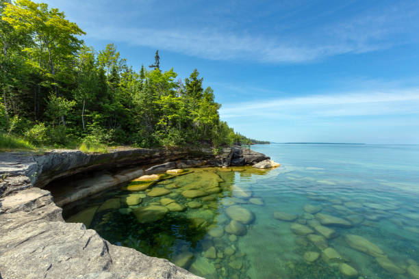
The clear waters of Lake Superior reveal large rocks and stones underwater. This cove, with pristine waters, is located near Au Train Michigan. Near Pictured Rocks National Lakeshore in the Upper Peninsula of Michigan.
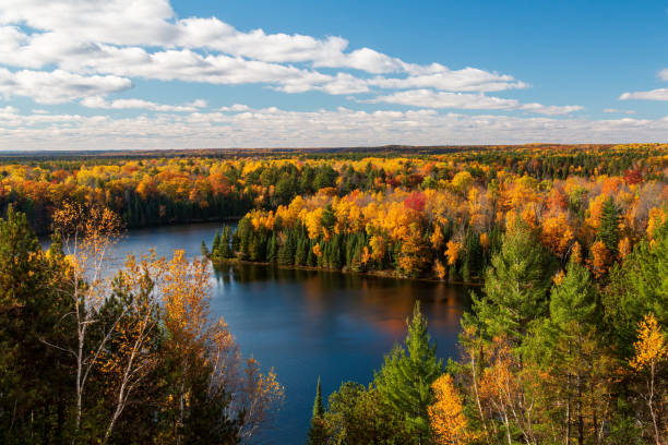
A sunny Michigan view of the AuSable River Cooke Dam Pond section on a bright autumn day with the forest in full fall colors
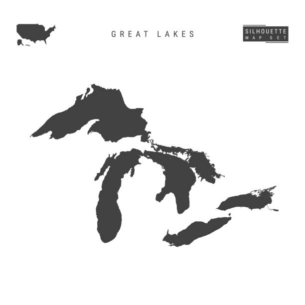
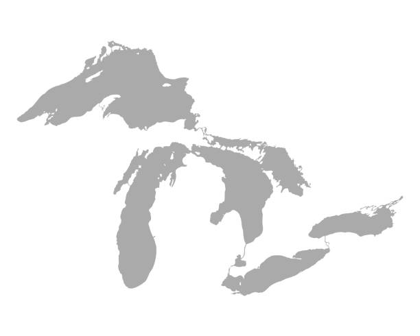
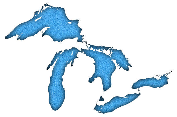
All the Great Lakes of North America Blank Vector Map Isolated on White Background. High-Detailed Black Silhouette Map of Great Lakes.
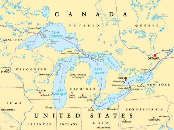
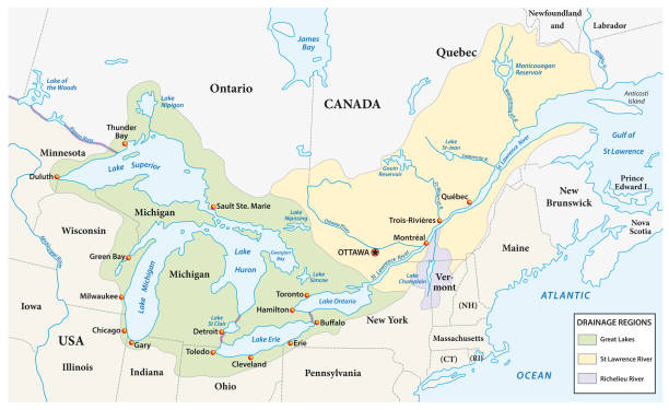
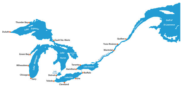
Great Lakes of North America political map. Lakes Superior, Michigan, Huron, Erie and Ontario. Series of large interconnected freshwater lakes on or near the border of Canada and of the United States.

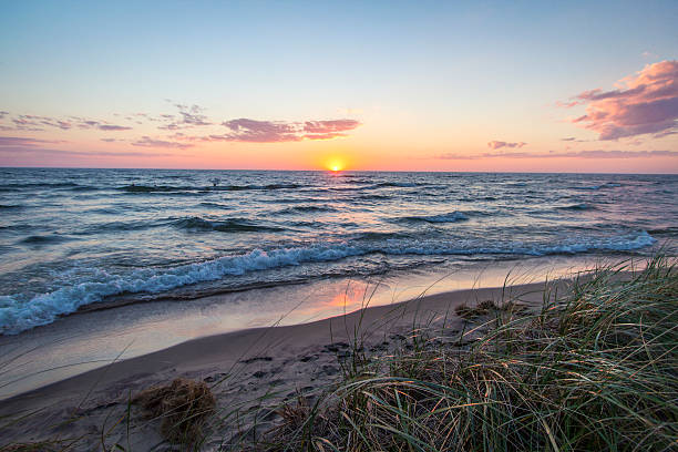
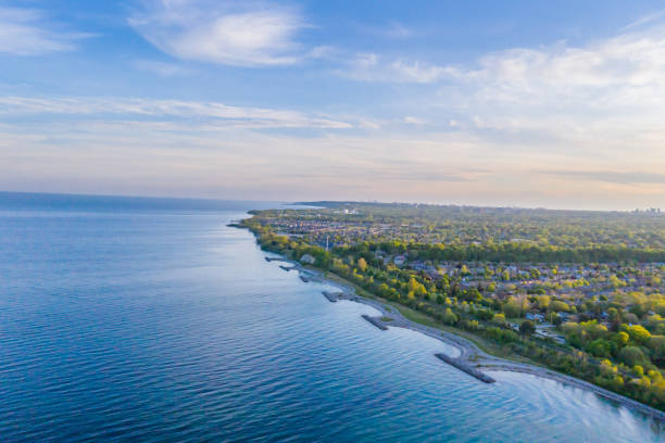
Sunset landscape as waves roll in on the beautiful coast of Lake Michigan at Hoffmaster State Park near Muskegon.
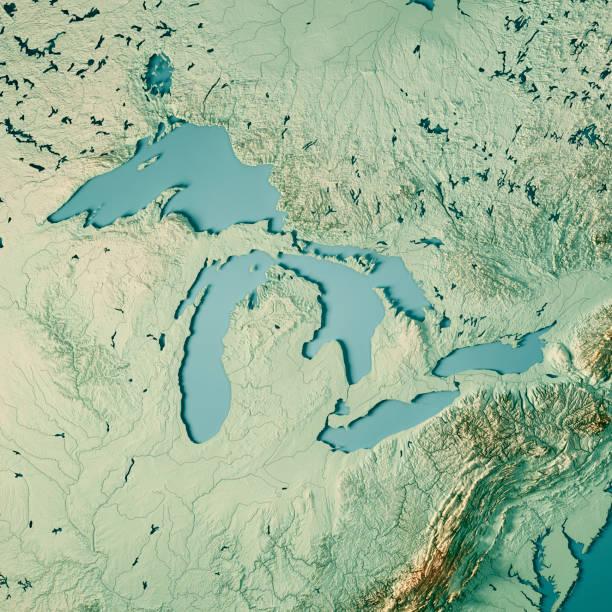
3D Render of a Topographic Map of the Great Lakes, USA and Canada. All source data is in the public domain. Color texture and Rivers: Made with Natural Earth. http://www.naturalearthdata.com/downloads/10m-raster-data/10m-cross-blend-hypso/ http://www.naturalearthdata.com/downloads/10m-physical-vectors/ Relief texture: SRTM data courtesy of USGS. URL of source image: https://e4ftl01.cr.usgs.gov//MODV6_Dal_D/SRTM/SRTMGL1.003/2000.02.11/ Water texture: HIU World Water Body Limits: http://geonode.state.gov/layers/?limit=100&offset=0&title__icontains=World%20Water%20Body%20Limits%20Detailed%202017Mar30
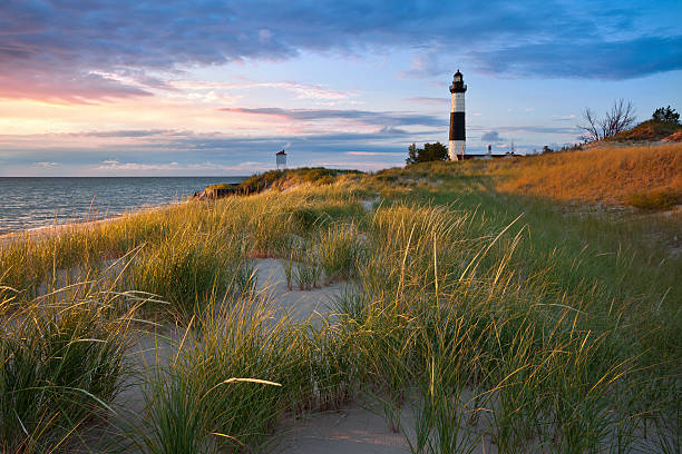
"Image of the Big Sable Point Lighthouse and the Lake Michigan shoreline, Michigan, USA."
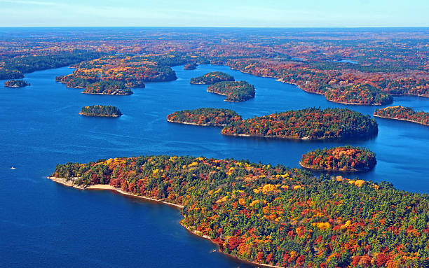
Georgian Bay with fall colors dotted islands from a plane
Travel, destination, hiking, walking, outdoor, camping
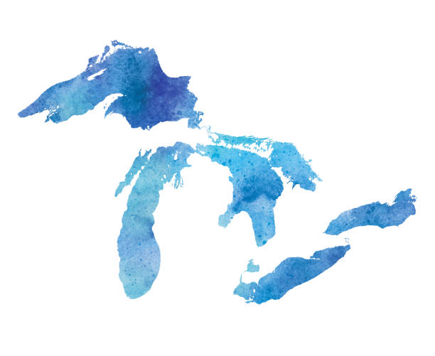
Great Lakes Watercolor Map. Raster illustration.
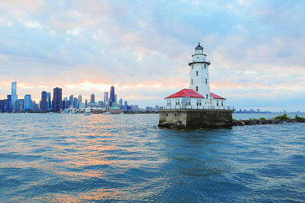
Chicago Lighthouse with City Skyline Background
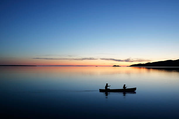
father and son in silhouette conoeing at twilight (XL)

St. Catharines, Canada.

Ship is sailing to Great Lakes at USA & Canada - blurred motion - Night Sailing at Canal - Long exposure.
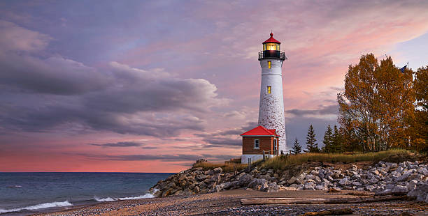
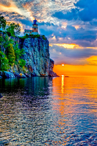
As daylight begins yielding to twilight, The Crisp Point Lighthouse at sunset on Lake Superior, Upper Peninsula, Michigan, USA - A one hour drive from Tahquamenon Falls, mostly dirt roads

Horseshoe bay island covered by winters snow.
The sunset over the beautiful shores of Lake Michigan with dune grass in the foreground and sunset reflections on the sandy beach.
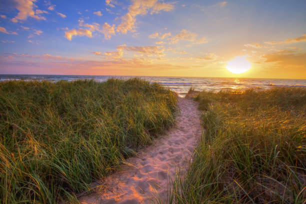
Sandy beach trail winds through dune grass to a sunset horizon on the shores of Lake Michigan in Hofffmaster State Park.

sunset and sea behind, Michigan
Autumn, Minnesota, Water, Trees, sunrise
A detailed map of the Great Lakes region. Includes major highways, cities, rivers and lakes. Each state is separate and grouped for easy color changes. Other elements are also grouped and separate. Includes an extra-large JPG so you can crop in to the area you need.
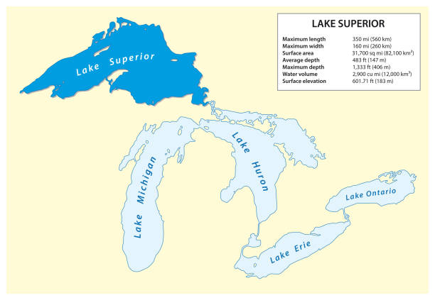
Information vector map of Lake Superior in North America.
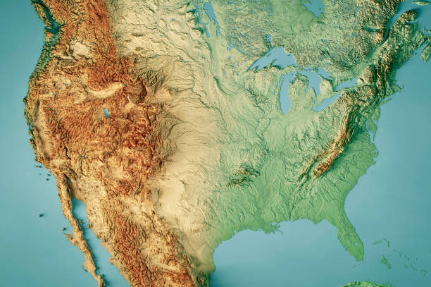
3D Render of a Topographic Map of the United States of America. All source data is in the public domain. Color texture: Made with Natural Earth. http://www.naturalearthdata.com/downloads/10m-raster-data/10m-cross-blend-hypso/ Relief texture: GMTED 2010 data courtesy of USGS. URL of source image: https://topotools.cr.usgs.gov/gmted_viewer/viewer.htm Water texture: SRTM Water Body SWDB: https://dds.cr.usgs.gov/srtm/version2_1/SWBD/
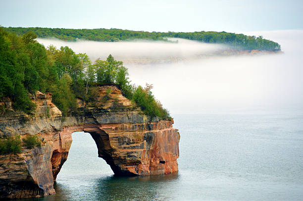
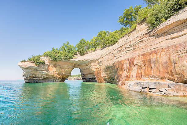
One of the arches along Pictured Rocks National Lakeshore in Michigan's Upper Peninsula.
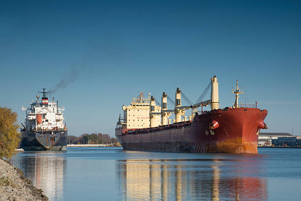
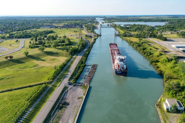
Two lake freighters passing on the exit from Lock 1 while navigating the Welland Canal,
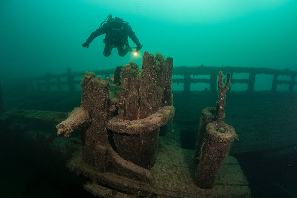
A scuba diver explores an old, wooden shipwreck in Lake Michigan. The waters of the Great Lakes are so cold that they preserve the many wrecks on bottom.
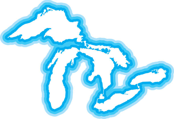
Vector illustration of a blue outlined Great Lakes icon.

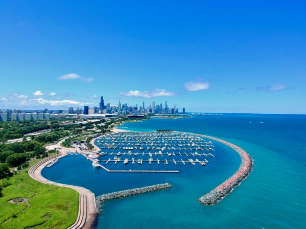
View of the Chicago downtown over lake Michigan. in Chicago, Illinois, United States
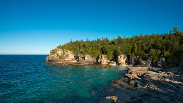
Bruce Peninsula National Park is a national park on the Bruce Peninsula in Ontario, Canada.
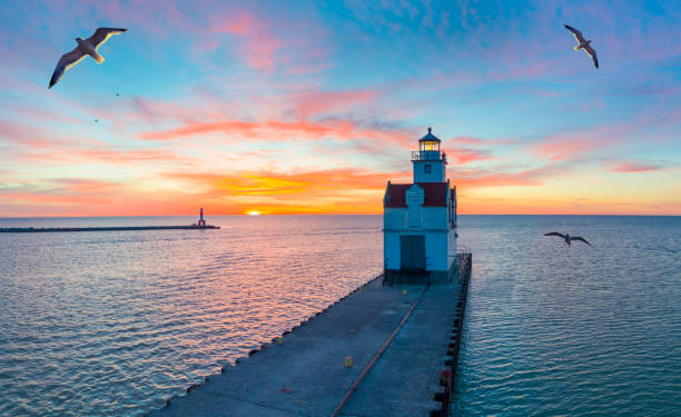
Sunrise over Lake Michigan scenic harbor and lighthouse with seagulls.
Lovers Leap, a named formation on Lake Superior in Pictured Rocks National Lakeshore, near Munising, Michigan. Mineral seepage creates the colors: Red and orange are iron, green and blue are copper, black is manganese, and white is lime.
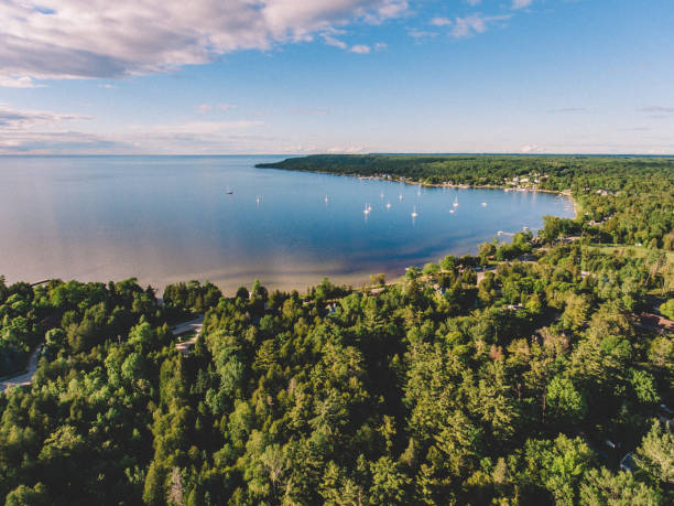
Aerial drone photography showing a picturesque view of downtown Ephraim, Wisconsin and the harbor. Ephraim is located on the Door County Peninsula in Wisconsin.
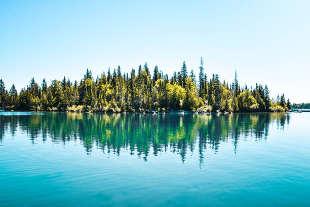
Tranquility at Isle Royale National Park in Michigan

A panoramic view of the very picturesque Tahquamenon Falls and Tahquamenon River during Autumn, Upper Peninsula, Michigan, USA
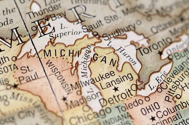
A close-up/macro photograph of Michigan and the Great Lakes from a desktop globe. Adobe RGB color profile.
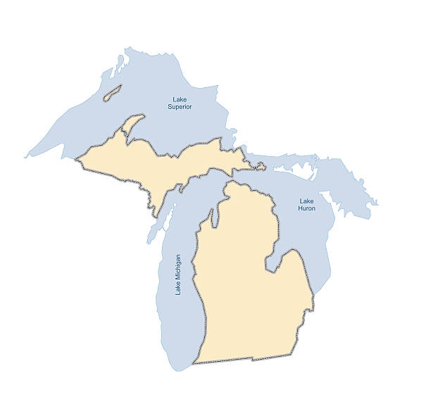
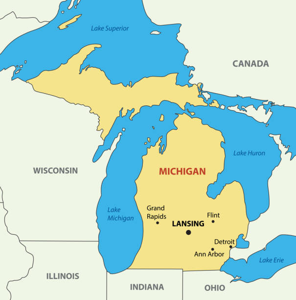
Vector illustration of the State of Michigan with surrounding lakes (Huron, Superior, Michigan). Comes with both .EPS and .AI vector files.
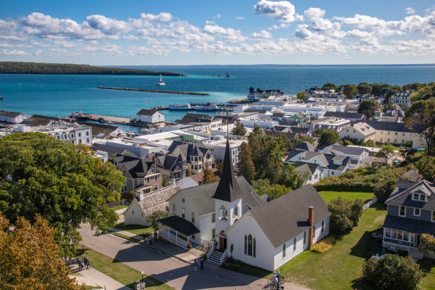
Mackinaw Island Town View, Michigan
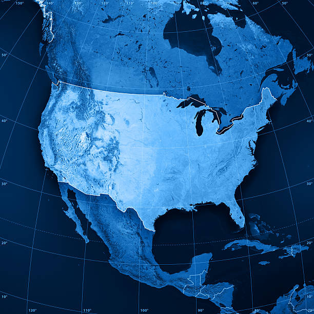
3D rendering and image composing: Topographic Map of the United States of America. Including country borders, rivers and accurate longitude/latitude lines. High resolution available! High quality relief structure!
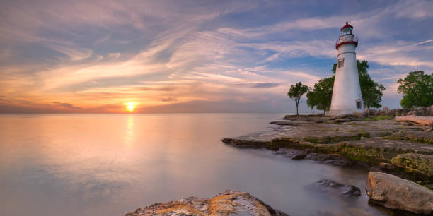
The Marblehead Lighthouse on the edge of Lake Erie in Ohio, USA. Photographed at sunrise.

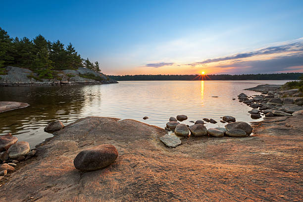
Looking out over the vast expanse and pure waters of Lake Superior from the coast of Rock Harbor on the Northern island of Isle Royale. Lichen covered rocks are in the forefront of view. Small islands covered in green evergreen trees can be seen in the distance. Located in the Upper Peninsula of Michigan.
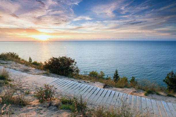
A colorful sunset over Lake Michigan shines its light on this boardwalk on Empire Bluff Trail near Empire Michigan. This trail overlooks Sleeping Bear Dunes
sunsrise
Vector illustration of a blue Great Lakes icon in flat style.

Downtown Chicago Skyscraper Cityscape along the Chicago River. Typical yellow Tourboat cruising on the Chicago River towards the Michigan Lake. Chicago, Illinois, USA.
