Landmass Pictures, Images and Stock Photos
Browse 1,100+ landmass stock photos and images available, or search for earth landmass to find more great stock photos and pictures.
Most popular
Flag of Ukraine, in the country silhouette. Bicolour national flag with two equally sized horizontal bands of blue and yellow. Outline of Ukraine, a country in Eastern Europe. Illustration over white.

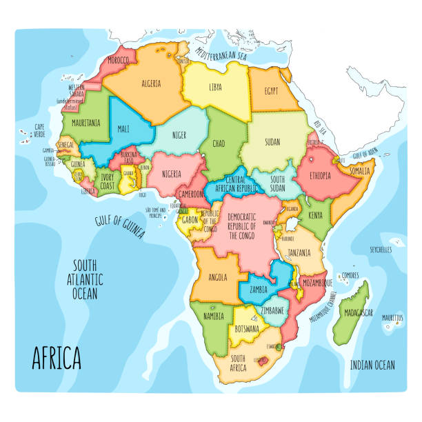
Africa regions political map with single countries. United Nations geoscheme. Northern, Western, Central, Eastern and Southern Africa in different colors. English labeling. Illustration. Vector.
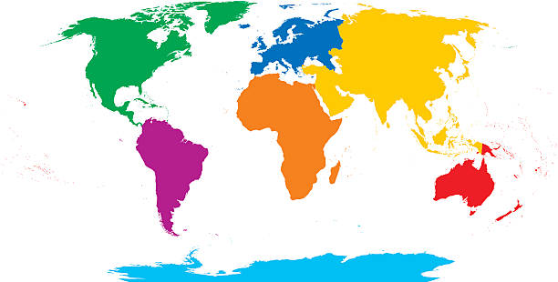
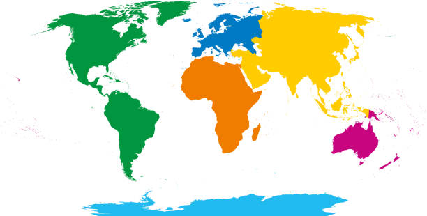
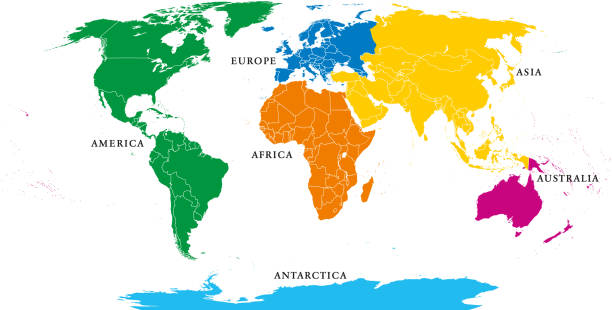
Seven continents map. Asia yellow, Africa orange, North America green, South America purple, Antarctica cyan, Europe blue and Australia in red color. Robinson projection over white. Illustration.
Clear glass ball 3D illustration on white background
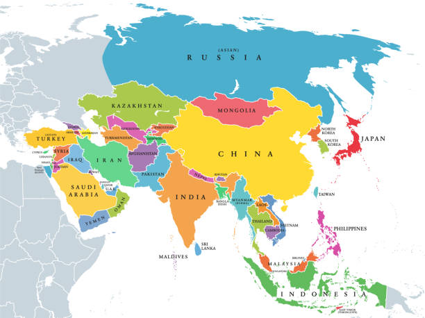
Main regions of Asia. Political map with single countries. Colored subregions of the Asian continent. Central, East, North, South, Southeast and Western Asia. English labeled. Illustration. Vector.

Africa, single countries, gray political map. Largest continent, including Madagascar. With English country names and international borders. Isolated illustration on white background. Vector.
![Blue glowing Earth crop [USA] Royalty free 3d rendering of a glowing earth. United States of America prominent. landmass stock pictures, royalty-free photos & images](https://media.istockphoto.com/id/172992255/photo/blue-glowing-earth-crop-usa.jpg?s=612x612&w=0&k=20&c=bx8T_B6rASYX-Gev_R2kUqJ3ULgIVdfQb5PCQZsM28I=)
Royalty free 3d rendering of a glowing earth. United States of America prominent.
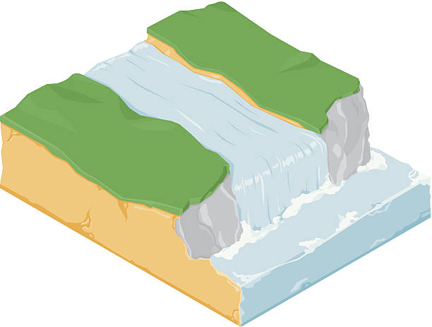
A vector illustration of an isometric landmass with cliffs and ocean.

Europe, gray political map. Continent and part of Eurasia, located in the Northern Hemisphere, with about 50 sovereign states. Map with borders and English country names. Gray illustration over white.

World political map. Detailed map of the world with shorelines, national borders and country names. Robinson projection, english labeling, grey illustration on white background.
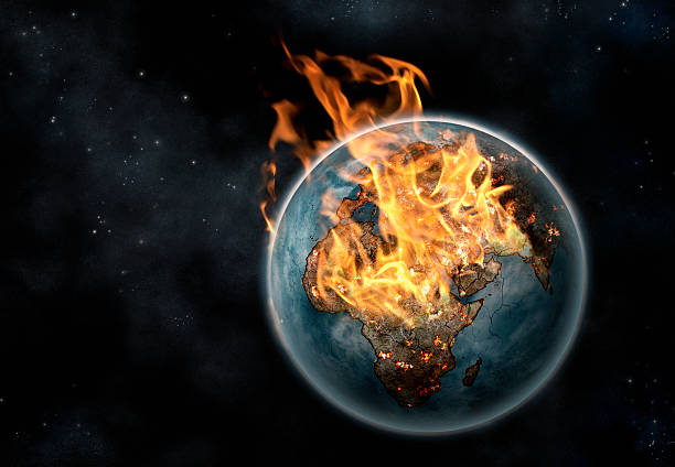
Digitally created image of the planet Earth erupting in flames viewed from space against a digitally created starry background. Africa, Europe and India are prominent beneath the flames. All photographic material in the image is original and has been created by me, Nick White and I have provided a release for that if it is necessary. The outline of the countries is hand drawn.

Six continents, world map. Africa, America, Antarctica, Asia, Australia and Europe. Outline and colored shapes. Robinson projection. Isolated on white background. Vector.
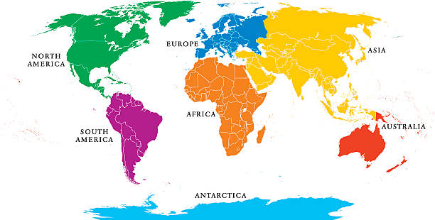
Seven continents map with national borders. Asia, Africa, North and South America, Antarctica, Europe and Australia. Detailed map under Robinson projection and English labeling on white background.
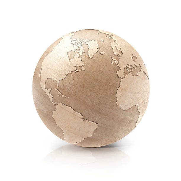
Wood North and South America world map 3D illustration on white background
![Blue glowing Earth [Lower Asia] Royalty free 3d rendering of a glowing earth. Image is big enough for you to choose the cropping. Lower Asia and Indian Ocean prominent. landmass stock pictures, royalty-free photos & images](https://media.istockphoto.com/id/173027360/photo/blue-glowing-earth-lower-asia.jpg?s=612x612&w=0&k=20&c=ZKMWsA3ODlhzzzESzt3lLAMjq8Zyz9DHwOyd0ws4tpA=)
Royalty free 3d rendering of a glowing earth. Image is big enough for you to choose the cropping. Lower Asia and Indian Ocean prominent.
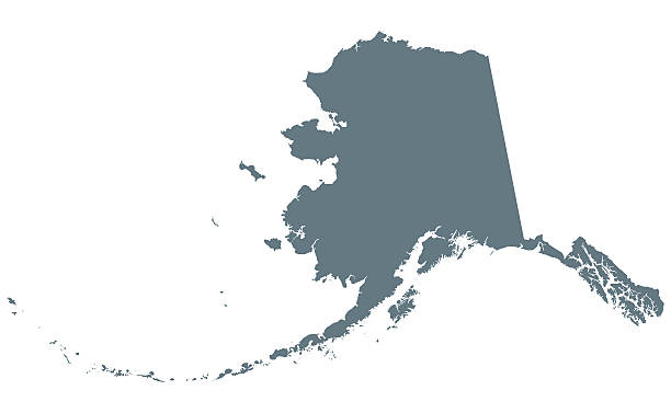
Alaska silhouette. U.S. state in the northwest of the Americas. Dark gray colored illustration on white background.


![Blue glowing Earth crop [Europe] Royalty free 3d rendering of a glowing earth. Europe prominent. landmass stock pictures, royalty-free photos & images](https://media.istockphoto.com/id/173031936/photo/blue-glowing-earth-crop-europe.jpg?s=612x612&w=0&k=20&c=8jyPQ_dstJPUo7Gtdykt69545LORXCX6s3ZlK_mZ9yQ=)
Royalty free 3d rendering of a glowing earth. Europe prominent.
Six continents, political world map, with borders. Africa, America, Antarctica, Asia, Australia and Europe. Robinson projection. English labeling. Isolated illustration on white background. Vector.
![Blue glowing Earth [South America] Royalty free 3d rendering of a glowing earth. Image is big enough for you to choose the cropping. South America prominent. landmass stock pictures, royalty-free photos & images](https://media.istockphoto.com/id/173019219/photo/blue-glowing-earth-south-america.jpg?s=612x612&w=0&k=20&c=qDUTLgBa-uMk8MYlvawX7VdiK9LlY8jsJO_f_qNf34E=)
Royalty free 3d rendering of a glowing earth. Image is big enough for you to choose the cropping. South America prominent.
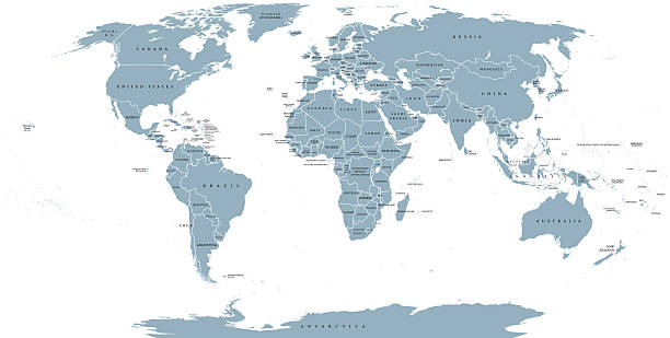
World political map. Detailed map of the world with shorelines, national borders and country names. Robinson projection, english labeling, grey illustration on white background.
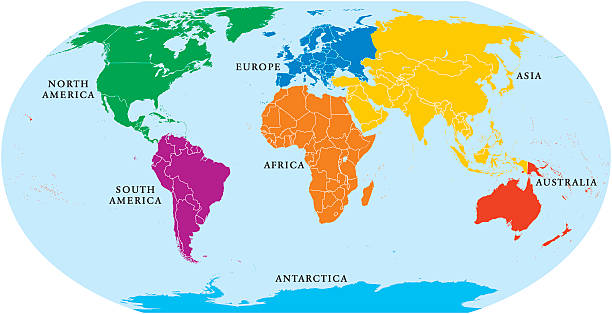
Seven continents world map. Asia, Africa, North and South America, Antarctica, Europe and Australia. Detailed map with shorelines and national borders under Robinson projection on white background.
![Blue glowing Earth [Australasia] Royalty free 3d rendering of a glowing earth. Image is big enough for you to choose the cropping. Australasia prominent. landmass stock pictures, royalty-free photos & images](https://media.istockphoto.com/id/173010176/photo/blue-glowing-earth-australasia.jpg?s=612x612&w=0&k=20&c=Objot2EQaQ20pRitqzZZEnCyZLIAN4McWFFfFRNI4A4=)
Royalty free 3d rendering of a glowing earth. Image is big enough for you to choose the cropping. Australasia prominent.
A vector illustration of an isometric waterfall with grass and rocks. The water if also falling into a river below.


Six continents world, political map. America, Africa, Antarctica, Asia, Australia and Europe, with shorelines and borders. Robinson projection. English labeling. Isolated on white background. Vector.

Blue ball 3D illustration on white background

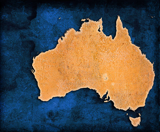
A background design of the continent of Africa imprinted on a piece of aged material.With plenty of copy-space.

Salt formations at Valle de la Luna (spanish for Moon Valley), also know as Cordillera de la Sal (spanish for Salt Mountain Range), Los Flamencos National Reserve, San Pedro de Atacama, Atacama desert, Antofagasta Region, Chile, South America
![Blue glowing Earth [North America] "Royalty free 3d rendering of a glowing earth. Image is big enough for you to choose the cropping. Canada, USA and Mexico prominent." landmass stock pictures, royalty-free photos & images](https://media.istockphoto.com/id/173019225/photo/blue-glowing-earth-north-america.jpg?s=612x612&w=0&k=20&c=CkjMyDXlqNjxa9Brwc44N4U4TXwQv6Zhj4_pfFkU0gw=)
"Royalty free 3d rendering of a glowing earth. Image is big enough for you to choose the cropping. Canada, USA and Mexico prominent."


Western New Guinea, gray political map. Also Papua, is a Western portion of the Melanesian island of New Guinea, administered by Indonesia, with the provinces Papua and West Papua. English labeling.
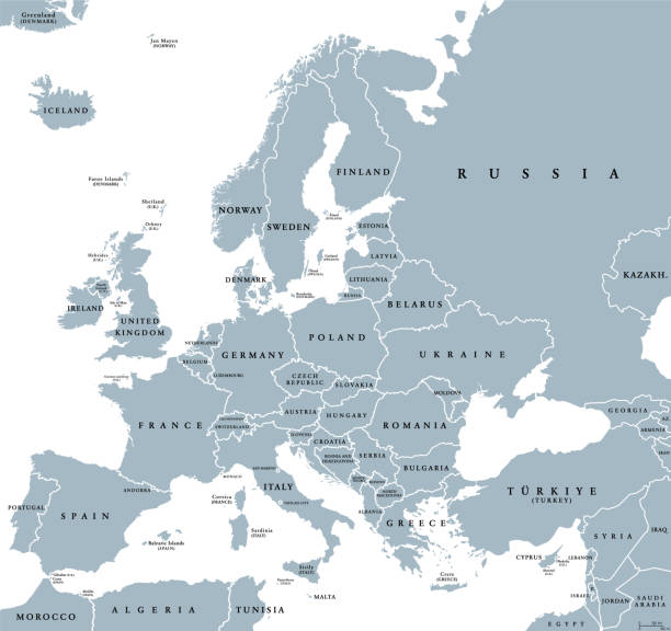
Europe with a part of the Middle East, gray political map. Western part of the continent Eurasia, located in the Northern Hemisphere. Countries with international borders and English labeling. Vector

Several different sizes of tropical islands with beaches and houses in the open ocean. Around float boats. Aerial view

multi color parti-coloured bright glass

White Marble ball 3D illustration on white background
Blueworld series click here:


An isometric vector illustration of a Radio Tower Antenna use for transmitting and receiving wireless communications.
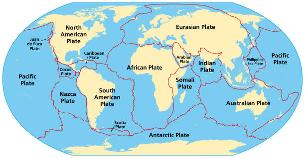
Map of the principal tectonic plates of the Earth. The sixteen major pieces of crust and uppermost mantle of the Earth, called the lithosphere, and consisting of oceanic and continental crust. Vector

Italian Republic flag in country silhouette. Landmass and borders of Italy as outline, within the banner of the nation in colors green, white and red. Isolated illustration on white background. Vector
A vector illustration of an isometric natural landmass with beach and ocean and sand.
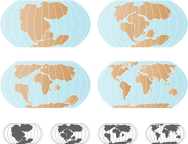
A set of 4 maps showing continental drift, starting with Pangaea (top left), the Triassic or Jurassic period (top right), the Cretaceous period (bottom left), and finally the continents as they are today. Black and white version included.

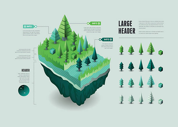
A 3D floating landmass illustration. EPS 10 file, with transparencies, layered & grouped,

![Blue glowing Earth [Atlantic Ocean] Royalty free 3d rendering of a glowing earth. Image is big enough for you to choose the cropping. Atlantic prominent landmass stock pictures, royalty-free photos & images](https://media.istockphoto.com/id/173010166/photo/blue-glowing-earth-atlantic-ocean.jpg?s=612x612&w=0&k=20&c=IvQg4oTSFPzl0y2rrJPDsDYGLt-L2UcRX4vs7Y8y9-M=)
Royalty free 3d rendering of a glowing earth. Image is big enough for you to choose the cropping. Atlantic prominent
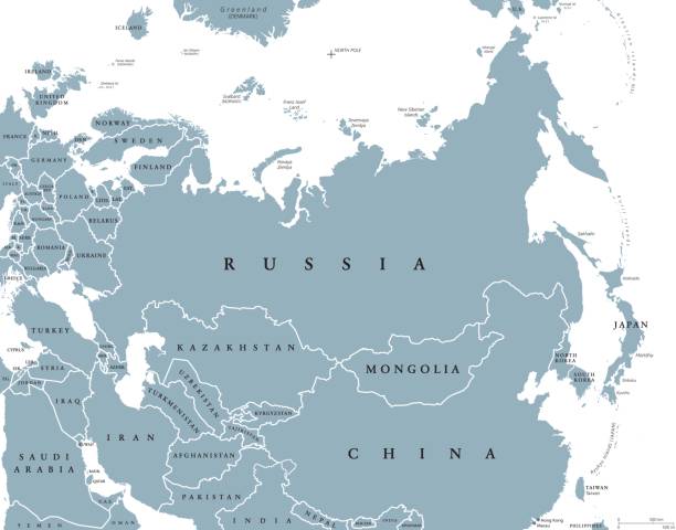
Eurasia political map with countries and borders. Combined continental landmass of Europe and Asia located in Northern and Eastern Hemispheres. Gray illustration over white. English labeling. Vector.
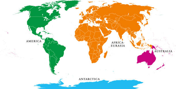
Four continents. World map with national borders. America, Africa-Eurasia, Australia and Antarctica. Political map under Robinson projection. English labeling. Isolated on white background. Vector.
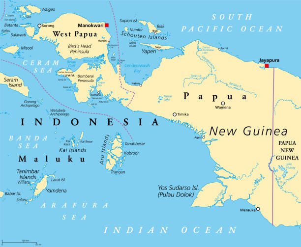
Western New Guinea, political map. Also known as Papua. Western portion of the Melanesian island of New Guinea, administered by Indonesia, with the provinces Papua and West Papua. English labeling.

World political map outline. Detailed map of the world with shorelines and national borders under the Robinson projection. Blue illustration on white background.

Stainless globe 3D illustration Asia & Australia map on white background

Several different sizes of tropical islands with beaches and houses. Around float boats and planes fly. View from above. Air traffic or domestic flights concept
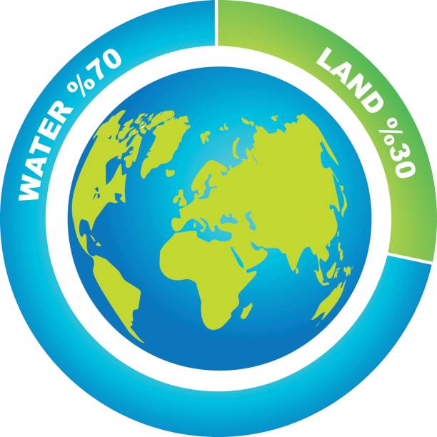
Graph shows percentage ratio of water and land on Earth`s surface